The National Weather Service has issued a Wind Advisory for the Mother Lode and the northern San Joaquin Valley, from 10 AM this morning until 4 PM Tuesday.
South winds of fifteen to twenty-five mph are forecast, with gusts up to forty-five mph. Gusty winds will blow around unsecured objects. Tree limbs could be blown down and a few power outages may result.
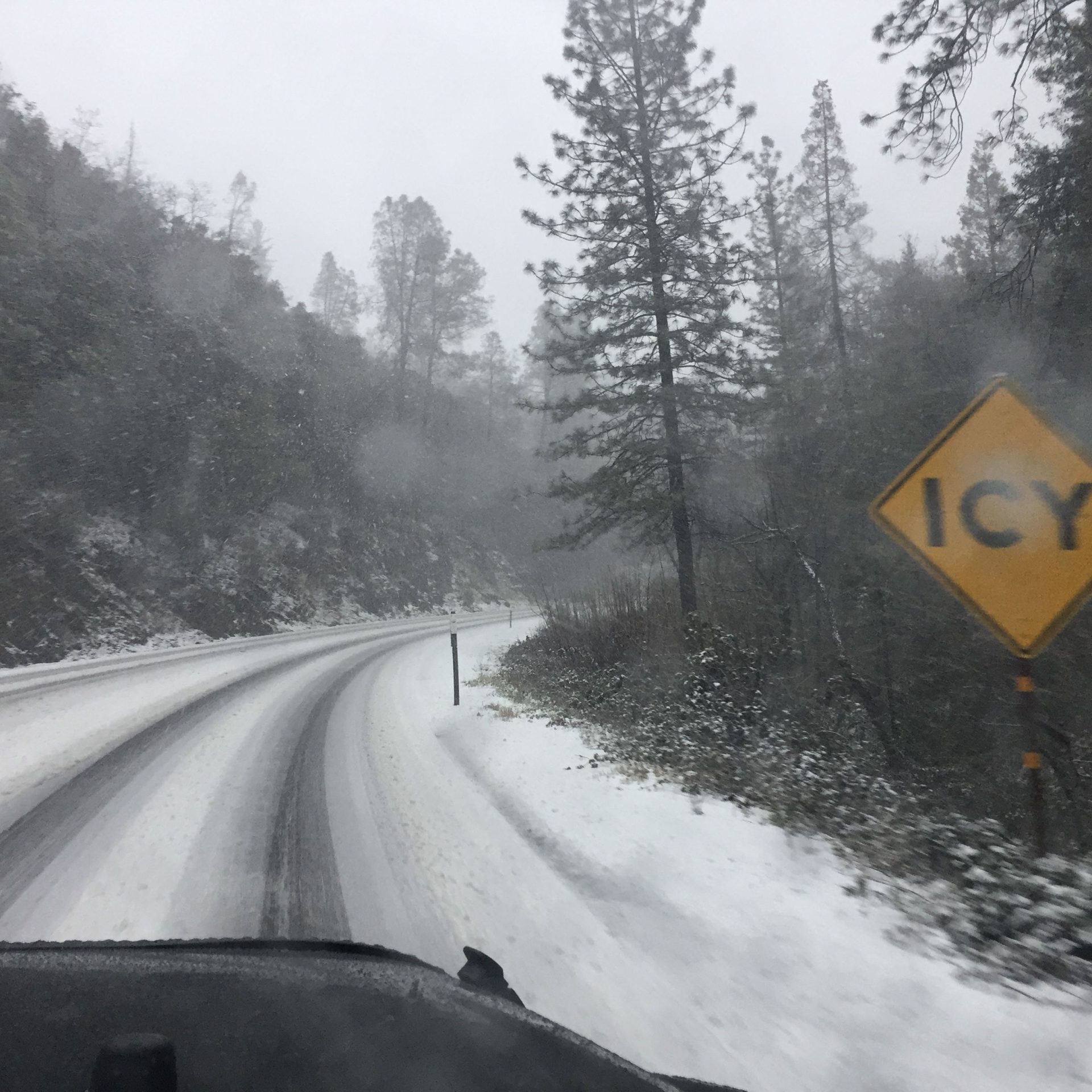
Winds this strong can also make driving difficult, especially for high profile vehicles. Use extra caution.
Additionally, a Winter Storm Warning has been issued for the western slope of the northern Sierra Nevada and Yosemite National Park, above the Valley floor, from 1 PM this afternoon until 10 AM Wednesday.
Heavy snow is expected.
The heaviest snowfall is expected late tonight into Tuesday, with snowfall rates of one to two inches per hour, possible at times.
The total snow accumulations above the 5,500 foot elevation will range from one to four feet. The higher you go, the more the snow. The highest snow amount will be above 8,000 feet.
Winds could gust as high as fifty-five to seventy mph. Such strong winds could cause widespread blowing snow, thus reducing visibility and causing tree damage.
Travel will be very difficult to impossible. Slick travel conditions are expected, with chain controls likely. Persons should delay all travel if possible. If travel is absolutely necessary, drive with extreme caution and be prepared for sudden changes in visibility. Leave plenty of room between you and the motorist ahead of you, and allow extra time to reach your destination. Avoid sudden braking or acceleration, and be especially cautious on hills or when making turns. Make sure your car is winterized and in good working order. If you must travel, keep an extra flashlight, food, and water in your vehicle in case of an emergency.
Finally, a Flood Watch has been issued for the northern San Joaquin Valley, the Mother Lode and western slope of the northern Sierra Nevada below 5,500 feet, from this afternoon through late Tuesday night. A Flood Watch will also be in effect for the lower Sierra Nevada and the foothills of Mariposa County, from Tuesday morning through Wednesday morning.
Flooding caused by excessive rainfall continues to be possible.
The heaviest period of rain will be from this evening into Tuesday night.
Periods of moderate to heavy rainfall is expected over the next 36 hours, with totals ranging from two to four inches in the Central Valley, three to eight inches in the foothills, and five to ten inches in the mountains.
Excessive runoff may result in flooding of rivers, creeks, streams, and other low-lying and flood-prone locations. Creeks and streams may rise out of their banks. Flooding may occur in poor drainage and urban areas. There is the potential for mud and rock slides in the foothills and mountains.
You should monitor later forecasts and be alert for possible Flood Warnings. Those living in areas prone to flooding should be prepared to take action should flooding develop.
The hazardous conditions could impact the Monday evening through Tuesday evening commutes.