




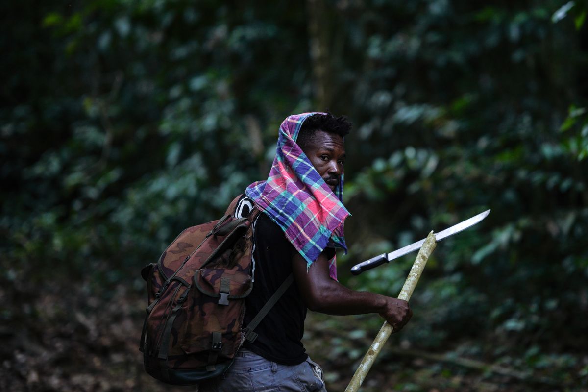

TUTUBUKA, Suriname (AP) — Deep in Suriname’s Amazon rainforest, Navaldo Vola hacked through thick vegetation with a machete, leading a group of Saamaka men up a forested mountain in sweltering heat and swarms of horseflies.
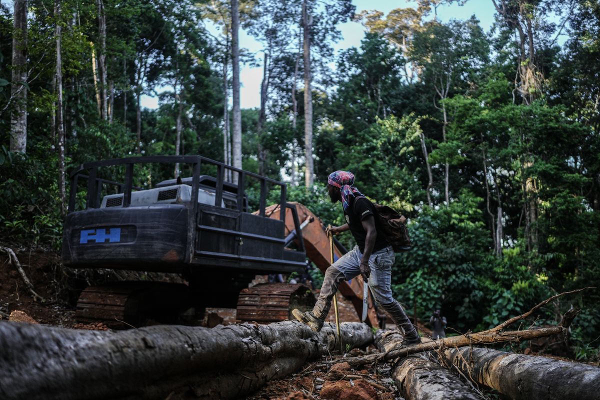
Halfway up, they found a massive abandoned excavator fitted with an attachment designed to tear down trees.
The discovery came a day after the men had found a makeshift camp at the foot of the mountain that they believed had been used by Chinese loggers. Packets of masala powder and bottles of soy sauce remained in the cooking area. They spent the night there, stringing their hammocks from the camp’s makeshift wooden structures before setting off up the mountain the following morning.
Beyond the excavator, near the summit, they found another camp, with pieces of plastic tarp, aluminum mugs and other items left behind.
“We knew that some people come here, but we didn’t know that they are doing logging,” Vola, 31, said, pointing into the distance at the summit of Ebbatop mountain. “This part is supposed to be untouched.”
As roads, logging and gold mining encroach deeper into Saamaka territory, communities are turning to modern technology to defend forests protected for generations — using satellite images, GPS mapping and patrols to track incursions.
In villages such as Tutubuka, officially known as Nieuw Aurora, along the Upper Suriname River, residents hope the evidence will help secure government recognition of their traditional forest management system, nearly two decades after an international court ordered Suriname to recognize their collective land rights, a ruling that remains largely unfulfilled.
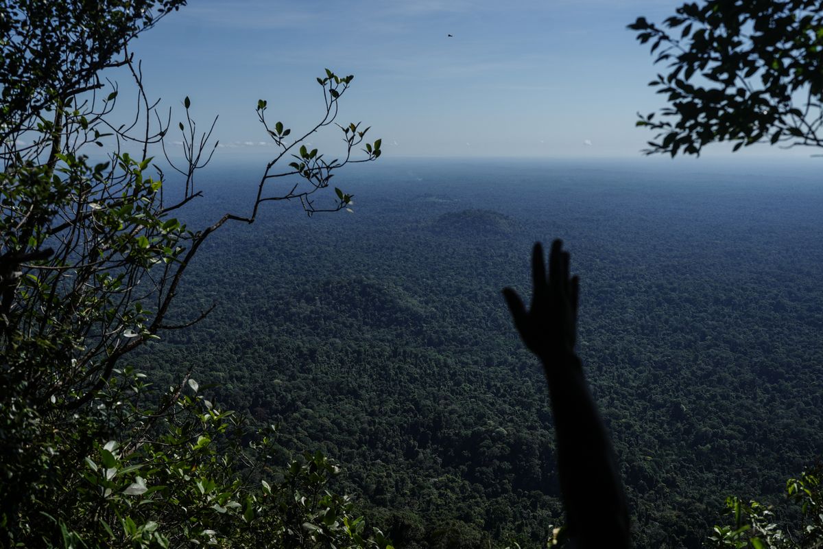
Last year, Suriname pledged to protect 90% of its tropical forests and strengthen conservation laws, potentially including legal recognition of the ancestral lands of Indigenous and tribal communities. The small South American country between Guyana, French Guiana and Brazil has a population of about 650,000 and is about 93% forested. Its forests span parts of the Amazon rainforest and Guiana Shield and absorb more greenhouse gases than the country emits.
Tribal territories in Suriname have lost nearly 154,000 hectares (380,500 acres) of forest since 2001 — roughly twice the size of New York City. Nationwide, about 200,000 hectares (494,000 acres) of humid primary forest were lost between 2002 and 2025, according to Global Nature Watch.
Mapping forests protected for generations
The Saamaka are one of Suriname’s six communities descended from Africans who escaped slavery on Dutch plantations and established autonomous settlements deep in the forest in the 17th and 18th centuries. After decades of fighting Dutch colonial forces, they secured a peace agreement in 1762 recognizing their freedom and autonomy. About 60,000 Saamaka people live in Suriname, according to the Association of Saamaka Communities, often called VSG.
For generations, Saamaka clans have governed how their forests can be used through traditional agreements, setting aside areas for farming while protecting others for their spiritual, cultural or historical importance.
Now, communities are mapping these traditionally protected areas to document their forest management system and strengthen their case for government recognition. They named the initiative Apaki in November 2025, after a container made from dried calabash fruit traditionally used to preserve food, symbolizing their efforts to safeguard the forest for future generations.
Hugo Jabini, managing director of VSG and a longtime land rights advocate, said roads are increasingly opening traditionally protected areas to outsiders. Jabini said the Palmera road, which began expanding in 2022 despite Saamaka opposition, now stretches roughly 253 kilometers (157 miles), according to community mapping, opening access to one of the most important Apaki areas.
Jabini, who won the Goldman Environmental Prize in 2009, grew up without a road linking his community to Paramaribo. When he first traveled to the capital to continue his education, part of the journey took four days by boat. From the late 1980s, roads began reaching deeper into Saamaka territory, turning journeys of days into hours — while opening once-inaccessible forests to outsiders.
“Within a couple of months,” he said, the road had pushed deep into the forest. “That’s how fast things go.”
John Goedschalk, an adviser to the president of Suriname on climate and biodiversity finance, said the government recognizes the Saamaka’s longstanding role in protecting the country’s forests and is open to working directly with their traditional authorities.
“Their mapping and satellite monitoring can help us enforce where the State alone cannot reach,” said Goedschalk.
He said talks with Saamaka leaders on forest protection are taking place in October and that the government is updating its legal framework to allow community-protected areas to be formally established.
Jabini, however, said he was unaware of any plans for such talks.
Satellites reveal new incursions
The documenting effort increasingly combines knowledge passed down through generations with satellite images and digital maps.
Sara Ramírez, a Colombian researcher working with VSG, said satellite analysis has detected changes in areas so remote that community members initially struggled to believe what they were seeing. Higher-resolution imagery later confirmed signs of activity in one such area.
The information can then guide helicopter flyovers or patrols like the one Vola joined, allowing communities to investigate suspicious clearings or roads first spotted from above.
“They have the information, and then they have the resources to go and check what is happening,” Ramírez said.
Ramírez said the technology is not replacing traditional knowledge but helping the Saamaka document a system outsiders have often failed to recognize. After elders saw maps and satellite images showing new logging and mining during a meeting, some concluded that they needed to formally document Apaki so outsiders could better understand how they have long managed their forests.
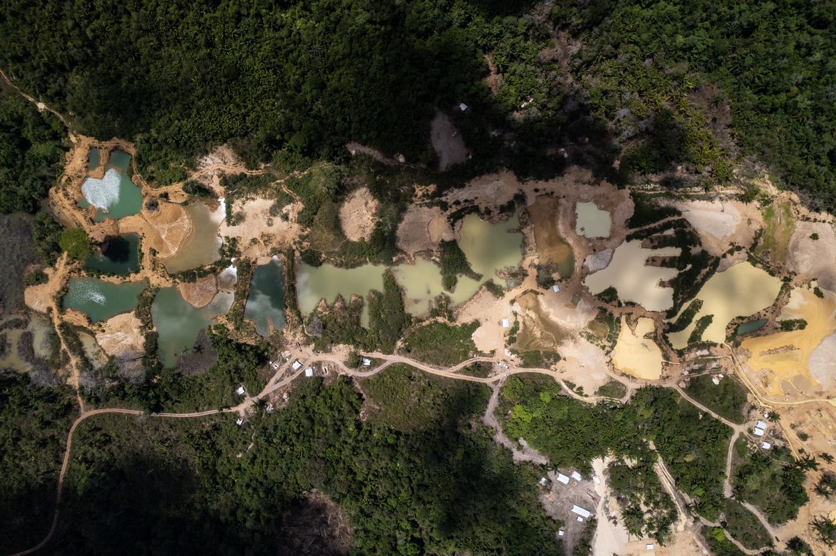
The Associated Press joined a helicopter flyover to see firsthand the expansion of logging and gold mining on Saamaka territory, much of it illegal and none approved by Saamaka authorities. From the air, the damage observed was far less extensive than in Colombia, Peru and Brazil, which are already heavily scarred from years of illegal mining and logging. But new roads and small clearings pushing into largely intact forest offered signs of how that footprint is quickly expanding in Suriname.
Natasha Donu, 49, secretary of VSG, said she was shocked by the scale of the new destruction.
“I’m very worried, because I didn’t know that many places were still being destroyed like that,” Donu said just after seeing the latest findings. “There are some places we weren’t expecting to see deforestation.”
Jabini said communities are also training young people to monitor the forest and collect data that can support complaints, negotiations and legal action.
Mapping alone cannot protect the forest
Mapping the forests will help the Saamaka document incursions and strengthen their case for government protection, but it does not give them legal title to the land.
In 2007, the Saamaka won a landmark case at the Inter-American Court of Human Rights after challenging logging and mining concessions granted in their traditional territory. The court ruled that Suriname had violated their property rights and ordered the government to demarcate their territory and grant them collective title. Nearly two decades later, Jabini says key parts of the legally binding ruling remain unimplemented, leaving communities without the legal authority to control what happens on their land.
Goedschalk, the adviser to Suriname’s president, said the president has imposed a moratorium on new gold mining concessions and extensions to ease pressure on the country’s interior. He also pointed to Suriname’s commitment to maintain 90% forest cover, saying cooperation with communities such as the Saamaka would be essential to meeting that goal.
Opposing mining interests can carry personal risks
Jabini said he received a death threat earlier this year after Saamaka communities challenged a gold-mining concession near Paba Creek, a major Apaki protected area. He reported the threat to police and temporarily changed his movements. Earlier threats drove him to live in the Netherlands from 2016 to 2022. Since returning, he said, he has taken greater security precautions and avoids publicizing his whereabouts.
There are divisions within Saamaka communities, too. Gold mining provides income for some residents, and Jabini acknowledges that those who depend on it may support the industry’s expansion, even as others fight to keep it out of protected forests. With Suriname preparing for an offshore oil boom, questions are also growing about how new wealth and development could affect the country’s forested interior.
For Saamaka leaders, the maps offer evidence of what their communities have protected for generations. But lasting protection, they say, depends on the government recognizing their territorial rights and stopping unwanted incursions.
For Vola, who helped lead the forest patrol, the stakes extend far beyond his own lifetime.
“This is our wealth and this is what we are fighting for,” he said. “Maybe a thousand generations from now, this must still be here like how our ancestors left it for us.”
___
The Associated Press’ climate and environmental coverage receives financial support from multiple private foundations. AP is solely responsible for all content. Find AP’s standards for working with philanthropies, a list of supporters and funded coverage areas at AP.org.
By STEVEN GRATTAN
Associated Press