Sacramento, CA — The Sierra Nevada is nearing the end of the typical snow season.
State Water officials report that the April 1st measurement is the most critical, which is typically the peak, before the melt-off.
The California Department of Water Resources did a monthly manual reading this past Friday at Phillips Station near Lake Tahoe, and at that location, it was only 58% of the average for the date. Sensors indicated that statewide, the average was in the 80 percentile.
Andy Reising, the DWR Manager of Snow Surveys and Water Supply Forecasting Unit, stated, “2015 was our lowest snowpack ever at 5% on April 1, so we are well ahead of that. So, it is a decent year. But, we certainly would like to see these storms that are perhaps out there in the next couple of weeks come to pass, and perhaps drop some good snow for us.”
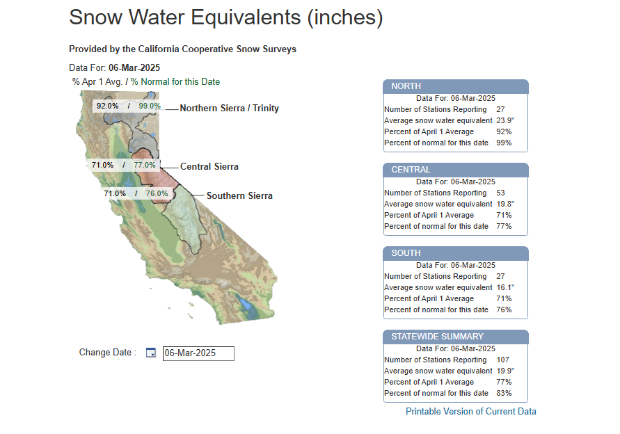
As of this morning, sensors note that the statewide average is 83% of average.
Northern California is faring the best at 99%, Central California is 77%, and Southern California is 76%.
More wet weather is forecasted throughout next week.