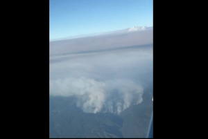
El Dorado County, CA — A two-week-old wildfire in El Dorado County expanded quickly yesterday and caused more evacuation orders around Lake Tahoe, as well as Amador County.
The Caldor Fire is 168,387 acres and 13-percent contained. It had been growing by about half a mile a day over the past few days. However, on Sunday, it grew by 2.5 miles.
CAL Fire spokesperson Ryan Luben says, “We did have a trying day and there were a lot of changes throughout the incident. Firefighters are working hard and trying to contain this fire as best we can.”
In the Tahoe area, people around the area known as Desolation Wilderness were ordered to leave. It was also threatening the area near Highway 89 in Amador County. Below is the latest on evacuation orders and warnings.
WHERE: El Dorado County and Alpine County
EVACUATION ORDER:
El Dorado County
-
- Desolation Wilderness from the watershed ridge to the CA ENF/CA TMU wilderness boundary. From the El Dorado/Placer county line to Echo Lakes.
Alpine County
-
- Highway 89 south, from Luther Pass Road to the Pickets Junction (Highway 88). West on Highway 88 to Kirkwood. South to include Kirkwood Ski Resort and Caples Lake.
- Highway 89 south, from Luther Pass Road to the Pickets Junction (Highway 88). West on Highway 88 to Kirkwood. South to include Kirkwood Ski Resort and Caples Lake.
EVACUATION WARNING:
El Dorado County
-
- The remaining area of the Lake Tahoe Basin. From the Alpine/El Dorado county line, north along the California/Nevada state line to Lake Tahoe. North along the waters edge to the El Dorado/Placer county line. West along the El Dorado/Placer county line to McKinney Lake.
- The remaining area of the Lake Tahoe Basin. From the Alpine/El Dorado county line, north along the California/Nevada state line to Lake Tahoe. North along the waters edge to the El Dorado/Placer county line. West along the El Dorado/Placer county line to McKinney Lake.
Alpine County
-
- Highway 88 at Forestdale Road. West of Forestdale Road and south to the Pacific Crest Trail Crossing. West of the Pacific Crest Trail to the Summit City Canyon Trail. West of Summit City Canyon Trail and south to the El Dorado / Stanislaus National Forest Line. El Dorado / Stanislaus National Forest Line west to the Alpine and Amador County line.
- South of Armstrong Summit to Woodfords to Forestdale Road, north of Highway 88 and Highway 89 to Armstrong Summit.

