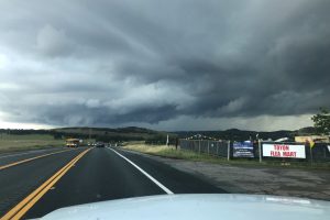
Update at 6 p.m.: The National Weather Service has ended the tornado warning for west central Calaveras and Southern Amador counties. Details on the warning are below.
Update at 5:20 p.m.: The National Weather Service has extended the tornado warning for west central Calaveras and Southern Amador counties to 6 p.m.:
NWS:
* At 511 PM PDT, a severe thunderstorm capable of producing a tornado
was located over Valley Springs, or near Paloma, moving northeast
at 15 mph.
HAZARD…Tornado.
SOURCE…Radar indicated rotation.
IMPACT…Flying debris will be dangerous to those caught without
shelter. Damage to roofs, windows, and vehicles will
occur. Tree damage is likely.
* This dangerous storm will be near…
Campo Seco around 520 PM PDT.
Paloma and San Andreas around 545 PM PDT.
PRECAUTIONARY/PREPAREDNESS ACTIONS…
TAKE COVER NOW! Move to a basement or an interior room on the lowest
floor of a sturdy building. Avoid windows. If you are outdoors, in a
mobile home, or in a vehicle, move to the closest substantial shelter
and protect yourself from flying debris.
Original post at 5:05 p.m.: Rancho Calaveras, CA — A tornado warning has been issued for parts of Calaveras, Amador, Stanislaus, and San Joaquin counties by the National Weather Service.
The warning is in place until 5:15 p.m. According to officials, a severe thunderstorm capable of producing a tornado was located near Rancho Calaveras and is moving northeast at 15 miles per hour toward Valley Springs. Flying debris will be dangerous to those caught without shelter. Damage to roofs, windows, and vehicles will occur.
Officials are asking people to take cover immediately and move to a basement, or an interior room on the lowest floor of a sturdy building and avoid windows. If you are outdoors, in a mobile home, or in a vehicle, move to the closest substantial shelter and protect yourself from flying debris.
* At 435 PM PDT, a severe thunderstorm capable of producing a tornado
was located near Rancho Calaveras, or 12 miles southwest of Paloma,
moving northeast at 15 mph.
HAZARD…Tornado.
SOURCE…Radar indicated rotation.
IMPACT…Flying debris will be dangerous to those caught without
shelter. Damage to roofs, windows, and vehicles will
occur. Tree damage is likely.
* This dangerous storm will be near…
Rancho Calaveras around 450 PM PDT.
Campo Seco around 505 PM PDT.
Valley Springs around 510 PM PDT.
Paloma around 515 PM PDT.


