San Andreas, CA — Calaveras County is turning to residents for direction to understand evacuation needs and create a plan for preparedness.

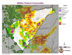
The goal is to build resiliency into the county’s transportation system from the impacts of catastrophic events and facilitate adequate and sustained access to and from high-risk communities during and after events. To facilitate a plan, county officials will combine Geographic Information Systems (GIS) mapping with community-provided anecdotal data to identify:
- Transportation system bottlenecks/chokepoints
- Locations where the transportation system is at risk from future disaster events
- Locations where the transportation network serves critical facilities such as hospitals and residences with mobility limitations
- Candidate areas for targeted improvements
- Provide recommendations for the next steps toward building a more resilient transportation network
The county’s plan process is to gather community input, identify needed projects, pursue grants and prioritize funding, and deliver priority projects. Residents are being asked to fill out three surveys related to community concerns, critical facilities and first responders. Click here to take the surveys.

