The National Weather Service has issued a Red Flag Warning for the central Sierra Nevada, effective until 9 PM Sunday.
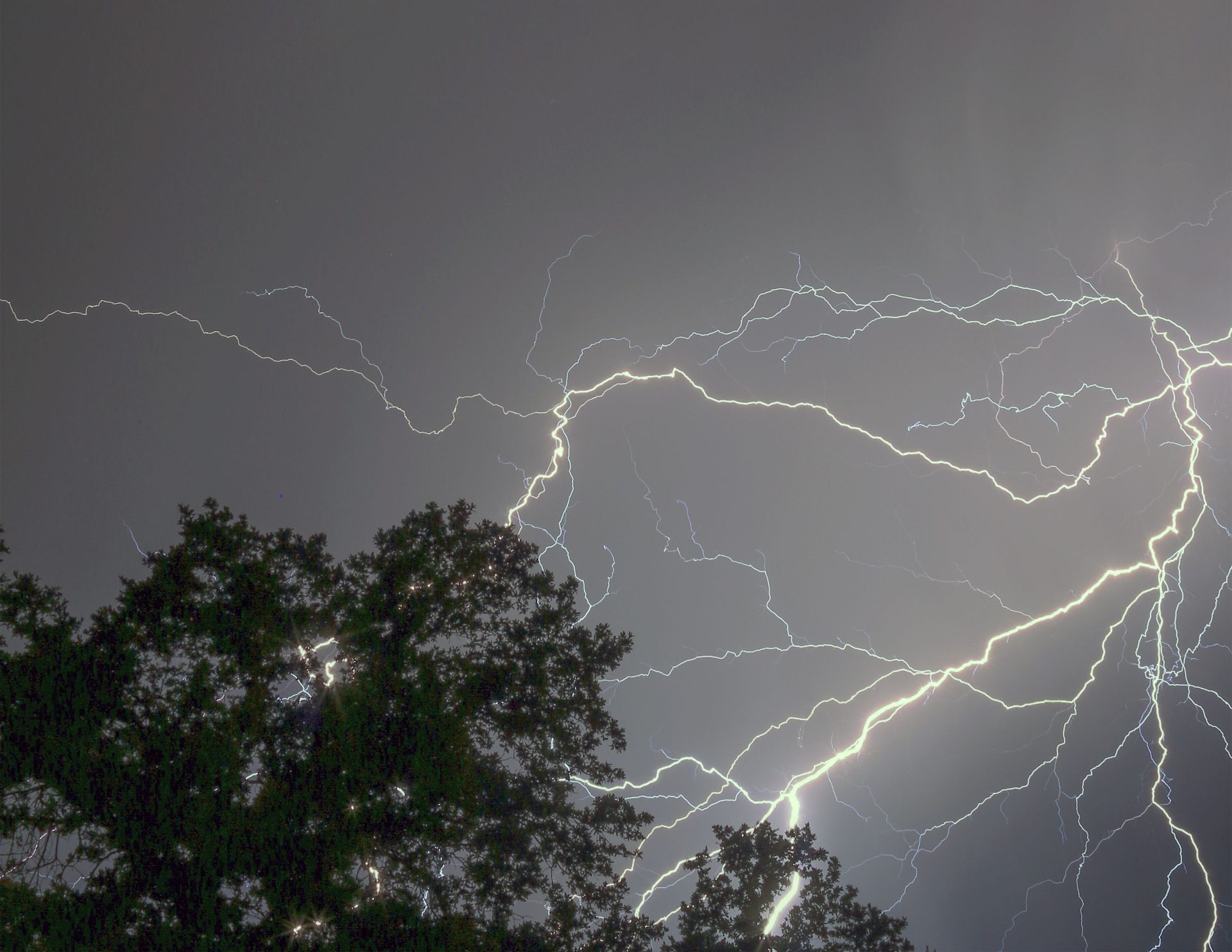
There is a 20 to 30% chance of thunderstorms, including dry lightning, each afternoon from today through Sunday. There is less than a 10% chance of wetting rain with these storms.
Thunderstorm potential is the greatest in the afternoon and evening on Saturday and Sunday.
Terrain-driven winds will range from 6 to 12 mph. Stronger, erratic wind gusts are possible in thunderstorm outflow.
The minimum daytime humidity levels will range from 15 to 25%.
Any fires that develop will likely spread rapidly due to dry fuels. Outdoor burning is not recommended.
A Red Flag Warning means that critical fire weather conditions are either occurring now, or will shortly. A combination of strong winds, low relative humidity, and warm temperatures can contribute to extreme fire behavior.
The Heat Advisory that is currently in effect for the western slope of the northern Sierra Nevada and the Excessive Heat Warnings for the Mother Lode and the northern San Joaquin Valley, have all been extended until 9 PM Saturday. The Heat Advisory for Yosemite National Park (outside of the Valley floor) and the Excessive Heat Warnings issued for the Yosemite National Park Valley floor, all of Mariposa County and the central San Joaquin Valley, have been extended until 10 AM Sunday.
Dangerously hot conditions continue with high temperatures that will range from 90 to 115 degrees, depending on your exact location. Widespread areas of Major to Extreme HeatRisk continue to exist.
Such well-above-normal temperatures continues to have a significant impact and is making outdoor activities more likely to cause heat-related illnesses than what most folks are used to, even in the upper Sierra Nevada.
This level of rare, long-duration extreme heat with little to no overnight relief affects everyone, especially those without effective cooling and/or adequate hydration. Heat related illnesses increase significantly during extreme heat events, particularly for those working or participating in outdoor activities.
Take extra precautions when outside. Wear lightweight and loose fitting clothing. Try to limit strenuous activities to early morning or evening. Take action when you see symptoms of heat exhaustion and heat stroke.
To reduce risk during outdoor work, the Occupational Safety and Health Administration recommends scheduling frequent rest breaks in shaded or air conditioned environments. Anyone overcome by heat should be moved to a cool and shaded location. Heat stroke is an emergency! Call 9 1 1.
There will be impacts likely in most health systems, heat-sensitive industries and infrastructure.
Drink plenty of fluids, stay in an air-conditioned room, stay out of the sun, and check up on relatives and neighbors. Do not leave young children and pets in unattended vehicles. Car interiors will reach lethal temperatures in a matter of minutes.
There is limited overnight relief with low temperatures ranging from the upper 60’s to the lower 80s.
Area waterways continue to run cold and fast, creating dangerous conditions for those seeking relief in rivers and lakes.
Stay cool, stay hydrated, stay informed.