Twain Harte Weather
Last updated Sat, July 4 2026 @ 09:30 pm
Twain Harte, CA
Today
10 PM
72˚
Cloudy
0%
11 PM
71˚
Cloudy
0%
12 AM
72˚
Cloudy
0%
1 AM
71˚
Cloudy
0%
2 AM
71˚
Cloudy
0%
3 AM
69˚
Cloudy
0%
Weekly Forecast
Sunday
July 5
82˚ / 65˚
Cloudy
0%
Monday
July 6
86˚ / 62˚
Clear
0%
Tuesday
July 7
85˚ / 62˚
Clear
0%
Wednesday
July 8
87˚ / 62˚
Clear
0%
Thursday
July 9
91˚ / 66˚
Clear
0%
Friday
July 10
93˚ / 68˚
Clear
0%
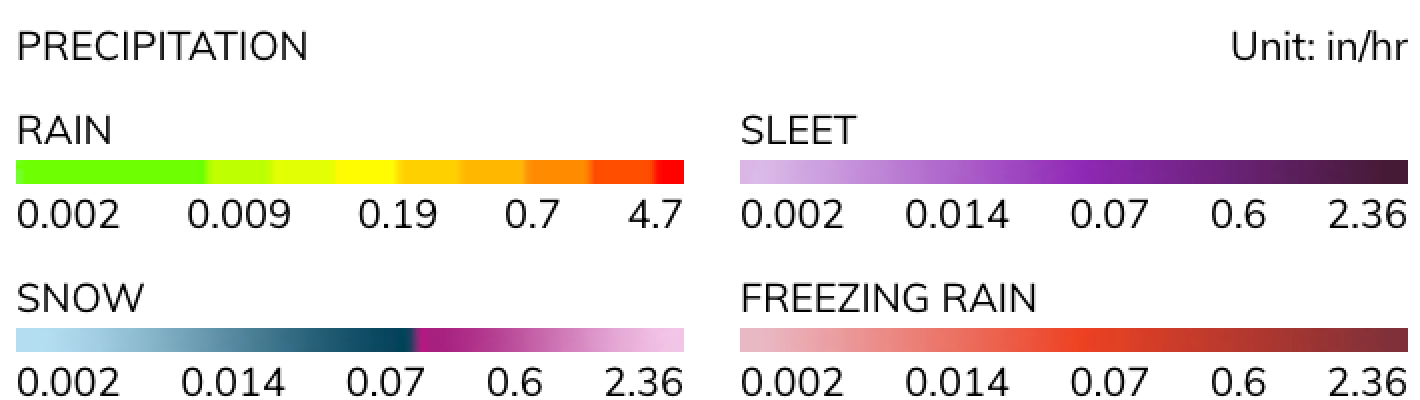
Radar


© Mapbox