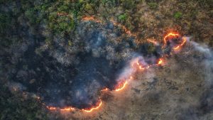
Sonora, CA– Researchers at the University of Southern California have developed an innovative model that combines artificial intelligence and satellite data to predict the spread of wildfires with unprecedented accuracy. This breakthrough could significantly enhance wildfire management and emergency response efforts. The research, published in the journal Artificial Intelligence for the Earth Systems, details how USC scientists utilize satellite imagery to monitor wildfires in real-time. The data is processed through a sophisticated algorithm, forecasting the fire’s path, intensity, and growth rate.
This advancement comes amid a severe wildfire season in California and across the western United States. With multiple fires fueled by wind, drought, and extreme heat, the Lake Fire stands as the largest, consuming over 38,000 acres in Santa Barbara County. The research team gathered historical wildfire data from high-resolution satellite images to understand how fires start, spread, and are contained. By analyzing these patterns, they identified factors such as weather, fuel type, and terrain that influence wildfire behavior. Using a generative AI-powered model called a conditional Wasserstein Generative Adversarial Network (cWGAN), the researchers simulated these factors to predict wildfire evolution. The model was trained to recognize patterns in satellite images corresponding to wildfire spread.
The cWGAN model was tested on real wildfires in California from 2020 to 2022. Despite initially being trained on simplified data, the model performed well when applied to actual fire conditions, thanks to its integration with real satellite data.

