




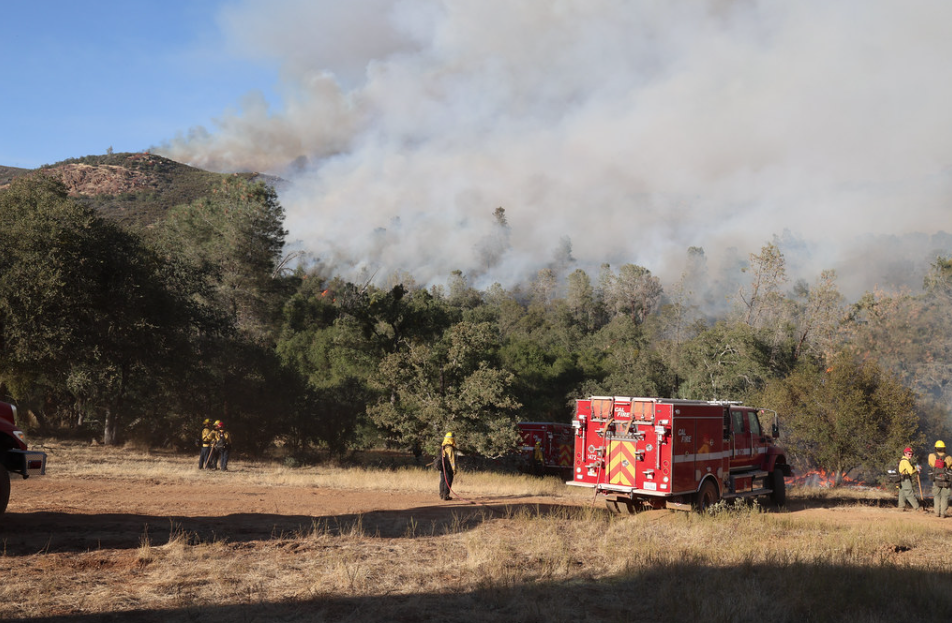
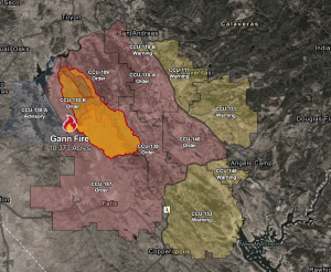
Valley Springs, CA — CAL Fire updates this morning that the Gann Fire is 10,373 acres and there is now 26% containment.
Seven structures have been destroyed by the fire that ignited on Monday near the intersection of Hogan Dam Road and Gann Road in Valley Springs. There has been one firefighter injury.
At a morning incident command briefing, Gabe Garcia, Planning Section Chief for the Incident Management Team Six (overseeing the operations), noted that the primary objectives are keeping the fire north of Rock Creek Road and Highway 4, south of Hogan Lake, east of Hogan Dam Road, and west of Highway 49.
There are now 2,715 firefighters assigned to the incident. Resources include 247 engines, 25 water tenders, 12 helicopters, 46 dozers, and 67 hand crews.
We reported yesterday that 65-year-old Herbert Wayne Smith of Valley Springs was arrested in connection with the fire. Investigators determined Smith was allegedly responsible for recklessly causing the fire, according to CAL FIRE. The agency said Smith was operating equipment capable of producing sparks near vegetation without following required fire prevention measures. Smith told KCRA 3 that he did not intentionally ignite the flames.
Evacuation information below is per the Calaveras County Sheriff’s Office, is below:
Current Evacuation Orders:
• Zone CCU-109
• Zone CCU-110-A
• Zone CCU-139
• Zone CCU-140
• Zone CCU-147
• Zone CCU-130-B
Current Evacuation WARNING Zones:
Zone CCU-110-B contains the Resource Connection of Amador and Calaveras Counties Food Distribution Center (Food Bank). The Food Bank, located at 206 George Reed Drive in San Andreas, will reopen and continue to operate during its normal business hours starting on 08/06. For additional information, please contact the Food Bank at (209) 754-1257.
Additional streets may not be listed below. Please refer to Genasys to identify your zone and monitor for any updates. The streets listed below are provided as a general reference to help identify areas currently under an Evacuation Warning.
• Zone CCU-111 – Calaveritas Road, Cement Plant Road, O’Connell Lane, Buckskin Way, Knief Lane, Edgewood, East Oak Park Drive, Park Drive, Airport Road
• Zone CCU-131 – Fourth Crossing Road, Fricot City Road, Dogtown Road, San Domingo Road, Sanctuary Lane, Schmauder Mine Road, Albright Court, Lakeside Drive
• Zone CCU-148 Finnigan Lane, Cuneo Road, Stockton Road
• Zone CCU-153 Appaloosa Road, Pinto Road, Pony Way, Buckskin Road, Sorrel Way, Hunter Street, Paint Road, Chestnut Way, Dunn Road, Filly Lane, Morgan Road, Stallion Way, Gelding Road
• Zone CCU-110-B George Reed Drive, Church Hill Road, Wendell Court, Toma Court
Road Closures & Updates:
• Pool Station Road at Cement Plant Road – Full Closure
• Pool Station Road at Highway 4 – Full Closure
• Hogan Dam Road at Hunt Road – Full Closure
• Bear Creek Day Use Area at Hogan Dam Road – Full Closure
Evacuation Center:
• Valley Springs Veterans Hall -189 Pine Street, Valley Springs, CA 95252
This evacuation center is available for displaced residents and their domesticated animals. Volunteers with the American Red Cross are on scene providing assistance.
Livestock Evacuation & Information:
Calaveras County Fairgrounds – 2465 Gunclub Road, Angels Camp, CA 95222 – 209-736-2561 ext. 101
• The Amador County Sheriff’s Office is assisting with livestock evacuation and transportation in partnership with OES. If you need assistance with transporting livestock, please contact 209-419-2000. The address where livestock will be taken is Laughton Ranch, located at 90 Clinton Road in Jackson. We sincerely thank the Amador County personnel for their assistance during this time.