The National Weather Service has issued a Winter Storm Warning for the western slope of the northern Sierra Nevada and Yosemite National Park, above the Valley floor, from 10 PM tonight through 10 PM Friday.
Heavy snow is forecast.
The snow levels will start off around 2,500 to 4,500 feet tonight, before rising to 4,500 to 7,000 feet through the day on Thursday.
The heaviest snowfall is expected on Thursday, with snow rates of one to two plus inches per hour at times.
Total snow accumulations from 4,500 and 6,000 feet, may range between five to fifteen inches. Above the 6,000 foot elevation, the total snow accumulations will range between two to eight feet. The higher you go, the more the snow.
Winds could gust as high as 60 mph. Strong winds could cause tree damage.
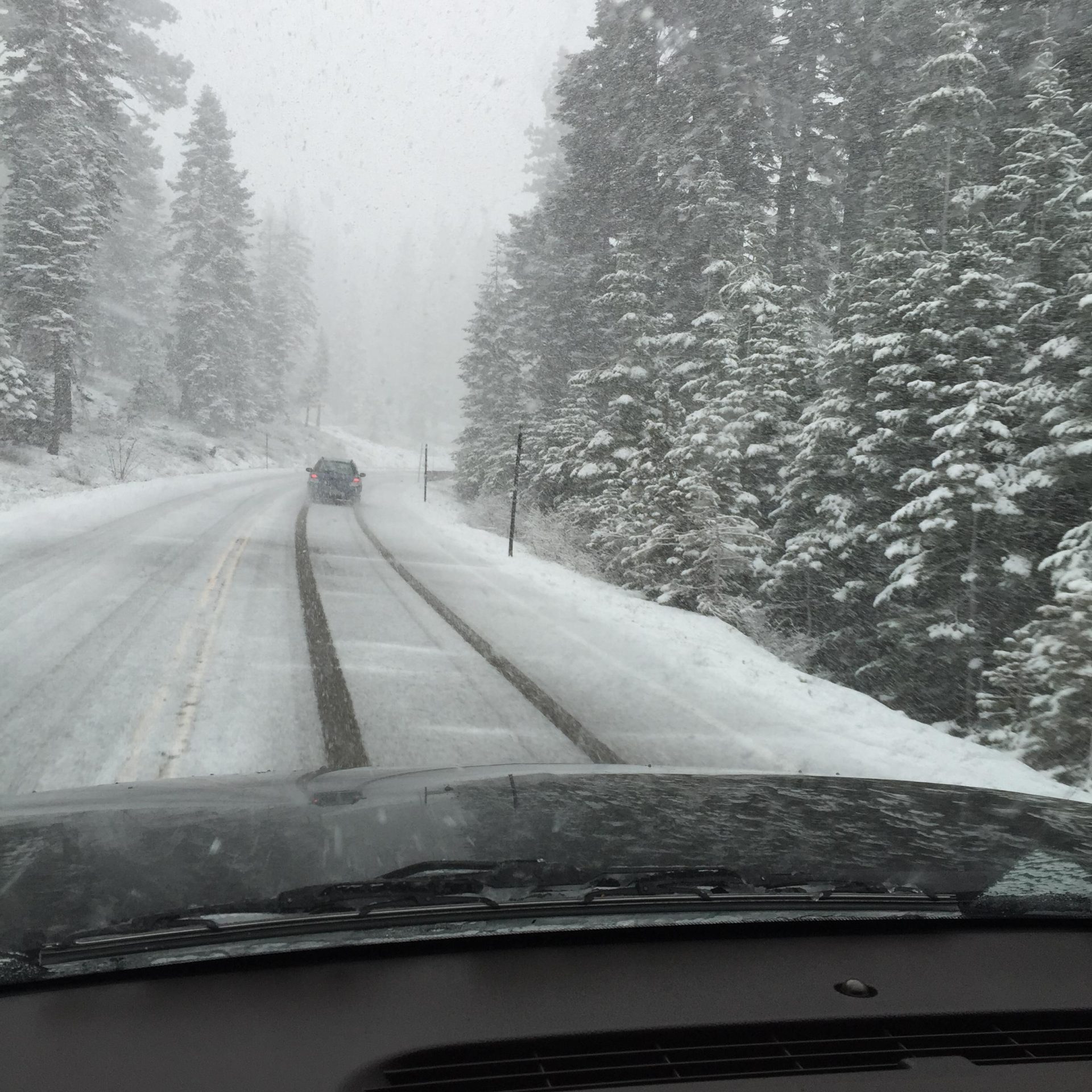
Travel could be very difficult to impossible. You may encounter very difficult travel conditions with chain controls and potential road closures.
If you must travel, keep an extra flashlight, food, and water in your vehicle in case of an emergency.
Additionally, a Flood Watch has been issued for the Mother Lode, the Mariposa County foothills, the Yosemite Valley floor, as well as the lower Sierra Nevada of Mariposa County and the western slope of the Sierra Nevada below 4,500 feet, starting at 10 PM this evening and continuing through Friday evening.
Heavy rainfall amounts are expected with this storm and flooding caused by excessive rainfall will be possible.
Periods of moderate to heavy rainfall is expected from late tonight into Thursday with rainfall totals of two to five inches in the foothills and mountains below the snow line.
Excessive runoff may result in flooding of rivers, creeks, streams, and other low-lying and flood-prone locations. Creeks and streams may rise out of their banks. Flooding may occur in poor drainage and urban areas. Low-water crossings may be flooded.
Given the very wet conditions over the past two weeks, minor flooding impacts are expected with any runoff that does occur. Debris flows over recent burn scars are not expected, but do expect increased muddy runoff.
You should monitor later forecasts and be alert for possible Flood Warnings. Those living in areas prone to flooding should be prepared to take action should flooding develop.
Finally, a Wind Advisory has been issued for the northern San Joaquin Valley, from 10 PM tonight until 10 AM Friday.
Southerly winds of fifteen to twenty-five mph are forecast, with gusts ranging from forty to fifty mph.
Such gusty winds will blow around unsecured objects so please secure outdoor objects now. Tree limbs could be blown down and a few power outages may result.
Winds this strong can also make driving difficult, especially for high profile vehicles.
The overall hazardous conditions could impact the Thursday morning and evening commutes.